High performance surveying equipment for precision alignment
Inefficient methods of alignment increase working hours, errors and ultimately leading to higher operating costs.
Using appropriate survey equipment allows you to easily meet requirements for as-built data and simplifies completion of jobsite documentation.
Using quality survey equipment allows accurate positioning in X, Y and Z, eliminating the need for re-work due to errors in positioning.
Intensify your performance and get error-free results at the best price-to-performance ratio. The Automatic Level is a dependable and durable tool specifically designed for construction professionals. With new ergonomic and solid-built design and full range of accessories and services, the automatic level provides great quality at affordable value.
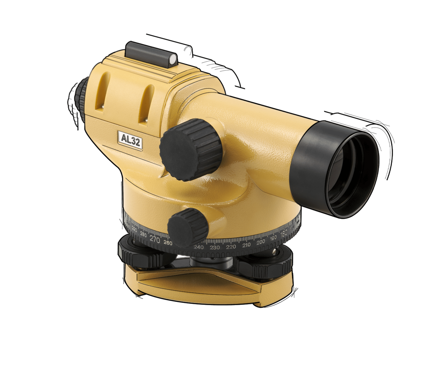
Air-damped compensator ensures stability, even under vibration and shock.
New design sturdy and durable housing rated to IP56 for use in any weather condition.
Fits flat and dome head tripods.
Do you have questions about our solutions? We are ready to help you!
Get in touch
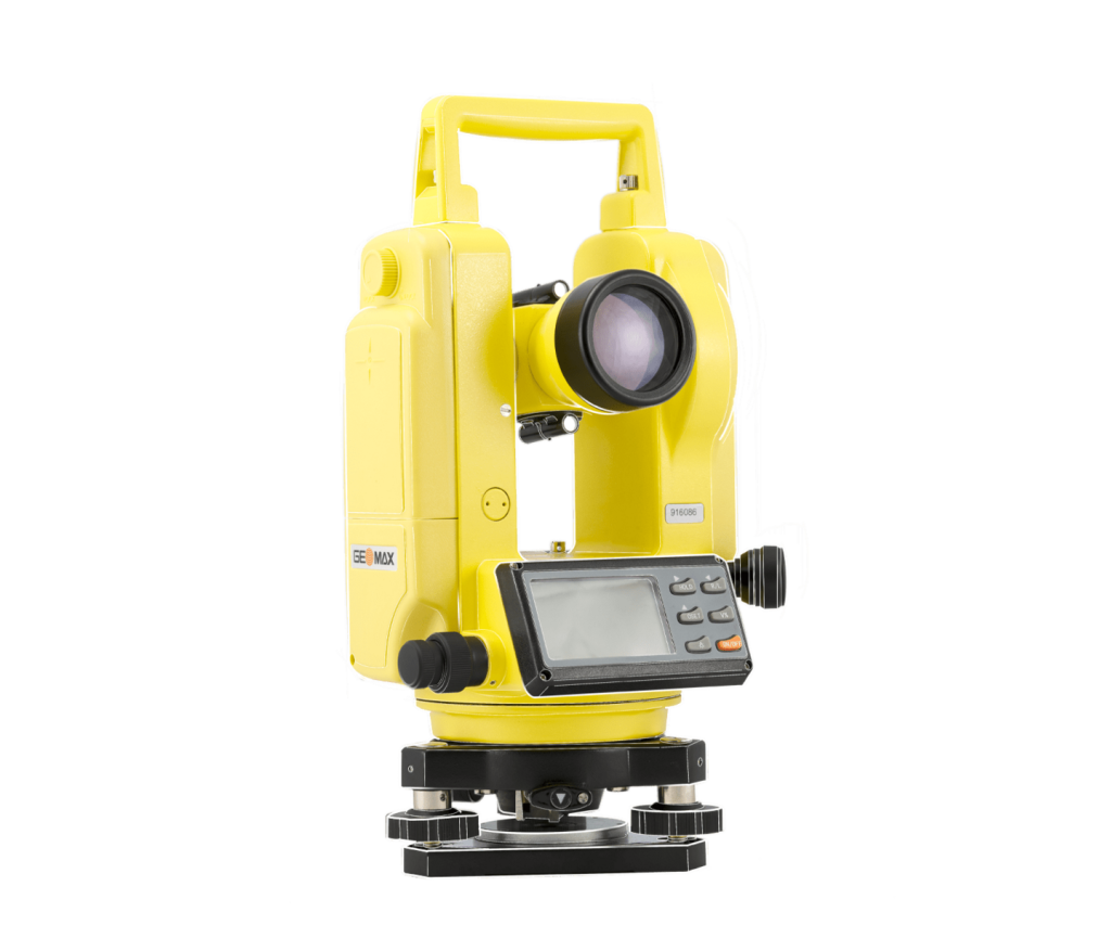
With vertical compensation and 2” accuracy the digital theodolite provides you with the precision required for your most demanding jobs for an affordable price without adding complexity. Various display modes, hold and set zero for horizontal angle, a variation of measurement units, simple distance measurement via stadia lines make an easy operation with only six keys. Visible laser plummet enables you to set up over a point faster and easier than ever. This is the tool of your choice when it comes to checking angles, alignments, grade work and short range levelling.
Rechargeable Ni-MH batteries & alkaline spare battery holder will ensure you never run out of power.
Dust & water resistant housing rated to IP54 for work in any weather conditions
Dual large back-lit LCD displays for quick setup and easy operation
Do you have questions about our solutions? We are ready to help you!
Get in touch
Vertical scanning beam allows for one person set-out or special applications like vineyards or fence lines
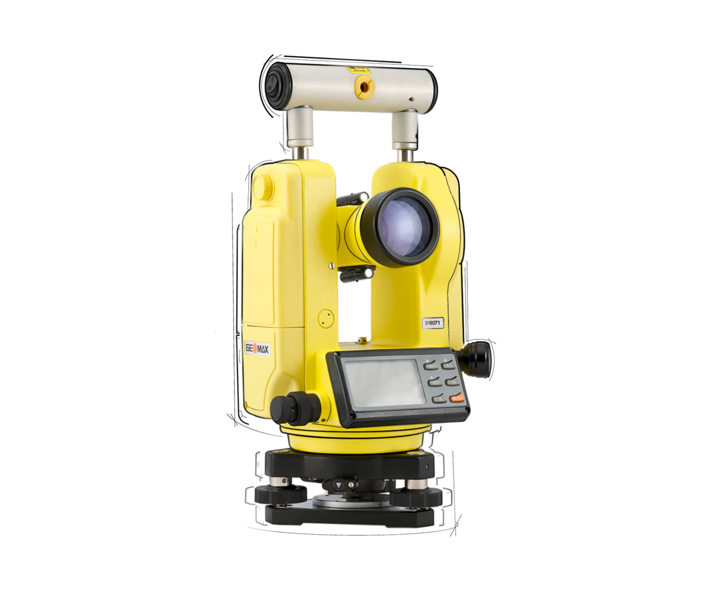
Ideal for vineyard and rural fencing contractors
Dust & water resistant housing rated to IP54 for work in any weather conditions
Dual large back-lit LCD displays for quick setup and easy operation
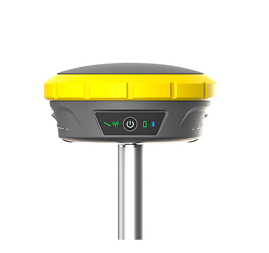
Remarkable operating temperature from -40°C up to +65°C is fully dust-tight, withstands powerful water jets and even temporary immersion under water and complies to international IP68 standard
The latest measurement engine enables you to receive multi-frequency signals form all existing satellite systems worldwide. Struggles with canopy - like working under trees, or inaccurate results because of multipath signals are significantly improved.
You can run the GeoMax X-PAD Ultimate software on a dedicted GeoMax field controller or your preferred software on your own devices. This GNSS antenna allows you to work in the way that best fits your needs.
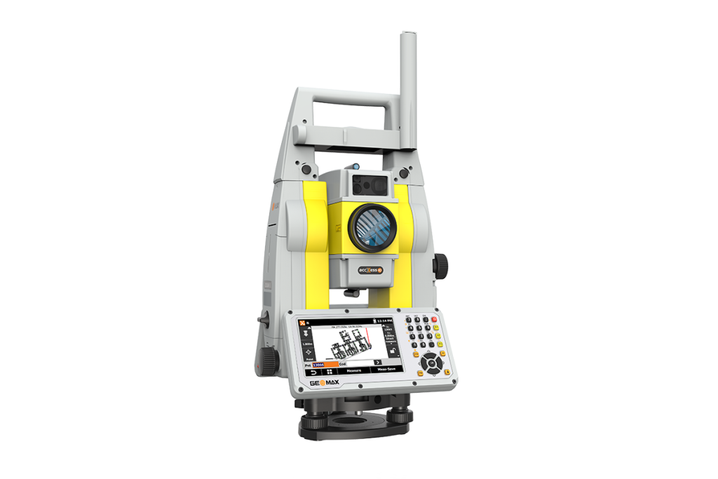
If you are in charge of surveying for construction projects or purchasing devices for your company, this one-person total station is made for you. The prism can be quickly located, tracked and stays locked with the built-in STReAM360 technology.
Combined with our X-PAD Ultimate software, which is open to 3rdparty field controllers and available in Windows and Android, Zoom95 provides a full range of efficient choices. X-PAD software suite has been developed based on our customer feedback. It perfectly matches Zoom95 workflows. It is so easy to use that no extra training is needed.
This solution is not only economical, with no maintenance cost, but your data is digitalised, secure and easy to access.
The device features a large 5-inch VGA touchscreen for clear and intuitive operation, paired with a powerful processor that ensures easy and fast handling of large files. It includes automatic data backup for enhanced security and reliability. Additionally, the Scout function enables quick and efficient searching for passive prisms across a wide area.
The field software options include X-PAD Ultimate Survey or Build for Android, as well as X-PAD Survey or Construction for Windows Mobile, offering flexibility to suit different platforms. Users can operate the system using GeoMax field controllers or their own compatible devices, allowing for a customizable and efficient workflow.
The field software comes with no maintenance costs, providing long-term savings and convenience. It incorporates the latest Hexagon technology, ensuring advanced performance and reliability. Additionally, an anti-theft feature with PIN/PUK protection enhances security and safeguards the device against unauthorized use.
Do you have questions about our solutions? We are ready to help you!
Get in touch
Nivcomp is the first leveling instrument of its kind to let you work alone and even around corners with better than 2 mm precision and cover up to ± 2.5 meters vertically over a 48 m radius. Nivcomp directly displays vertical measurements on a LCD, in large, easy to read digits, unlike conventional builderís optical and laser levels.
Nivcomp is extremely easy to use thanks to 1-person operation that requires no installation, tripods or special training. The flexible hose and the hand unit which can be used in horizontal or vertical orientation allows you to quickly and easily measure levels with 2mm accuracy, around blind corners, in radius of up to 48m.
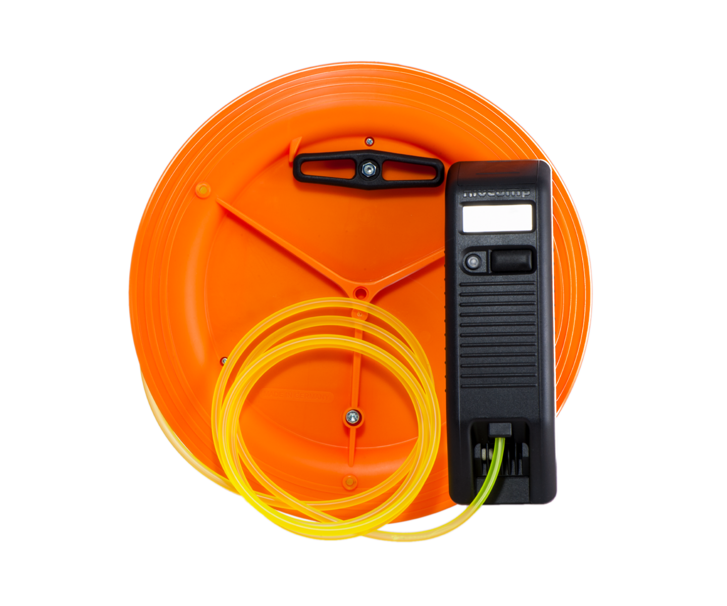
Nivcomp is designed to be operated by one person, with no installation or tripods required.
Nivcomp does not require line of sight and can therefore be used to measure levels around blind corners where lasers would not be able to reach.
Nivcomp does not require regular maintenance and does not require any special training before use.
Just fill out the form and the responsible person will be in touch as soon as possible.
Choose Your Desired MOBA Subsidiary / Region